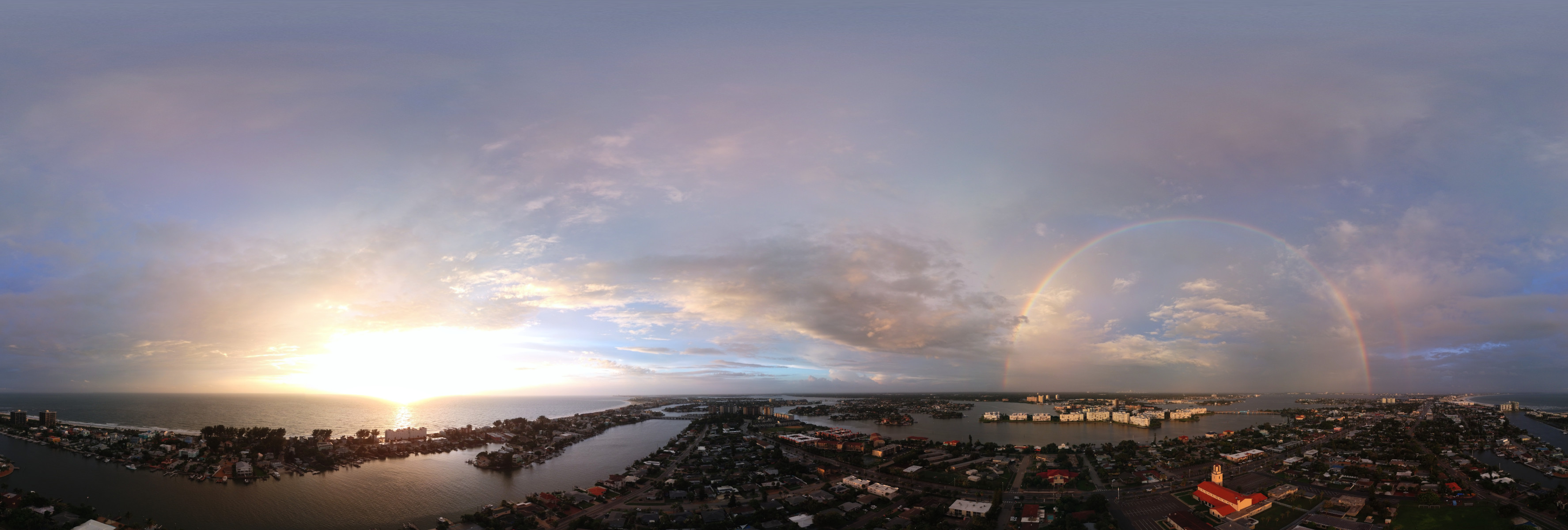
Picked anafi because of its ability to look up and capture spherical panoramas, works great with Microsoft i.c.e.
Problem, lots of wifi interference around, even at 300 ft above me line of sight.
have successfully completed autonomous missions with freeflight 6 even with red and black screens.
would like to set up a flightplan to go up to 300 ft take a spherical panorama and land, freeflight graphical interface allows for a drag and drop of a still photo at a waypoint but no opportunity to choose spherical. does anyone know a script I could paste into .Json to execute spherical panorama at my waypoint? Thanks in advance. If I should post this elsewhere please direct me there.